Financial Investment Network News (Reporter, Liu Min)Recently, at the departure ceremony of the international section of the "Belt and Road Initiative Global Tour", Autonavi Maps announced the official launch of its "World Map" product: applying the global positioning capabilities of the Beidou Satellite Navigation System (hereinafter referred to as the "Beidou System") to realize overseas route planning and navigation services; also based on itinerary positioning records, lighting up the countries and cities that users pass through along the way.
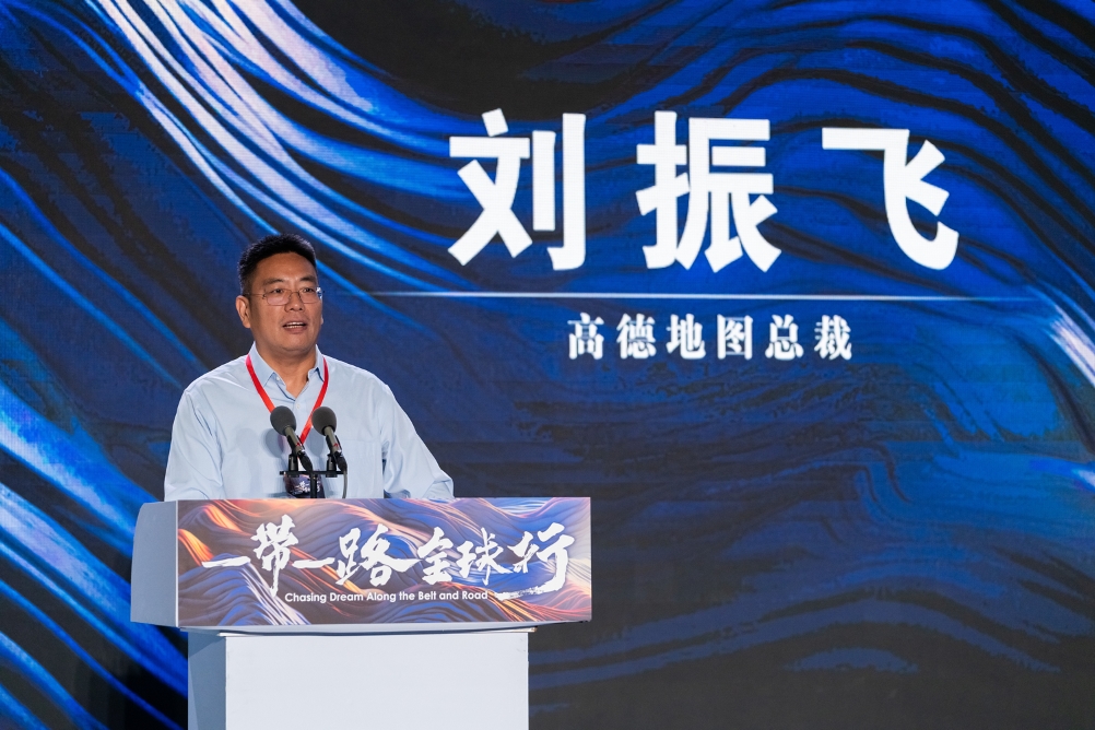
"The name World Map represents our vision: to create a world-class product that allows Chinese technology to light up the world." Liu Zhenfei, president of Autonavi Maps, introduced that the first thing to do is to make "a world map for Chinese people" to help Chinese users travel the world and help Chinese industries go overseas; in the future, we hope to go further and become "a world map for people of the world", based on China’s high-tech Autonavi map, to create a world product that serves people around the world.
In addition, as a global map navigation partner of the "Belt and Road Initiative Global Tour", Autonavi will continue to provide map navigation service support for the international segment of this event.
Beidou leads the way, Autonavi goes abroad
The official launch of the Autonavi world map is inseparable from the global positioning capability of the Beidou system.
Autonavi has been exploring the application of this country’s most important tool for many years – under the guidance and support of the China Satellite Navigation System Management Office, in recent years, it has launched innovative services such as lane-level navigation, traffic light countdown, blind spot meeting warning, etc., which have been well received by the majority of users and promoted the universality of this domestic high-tech technology in the field of civilian travel. At present, Autonavi maps call Beidou satellite daily positioning volume has exceeded 336 billion times.
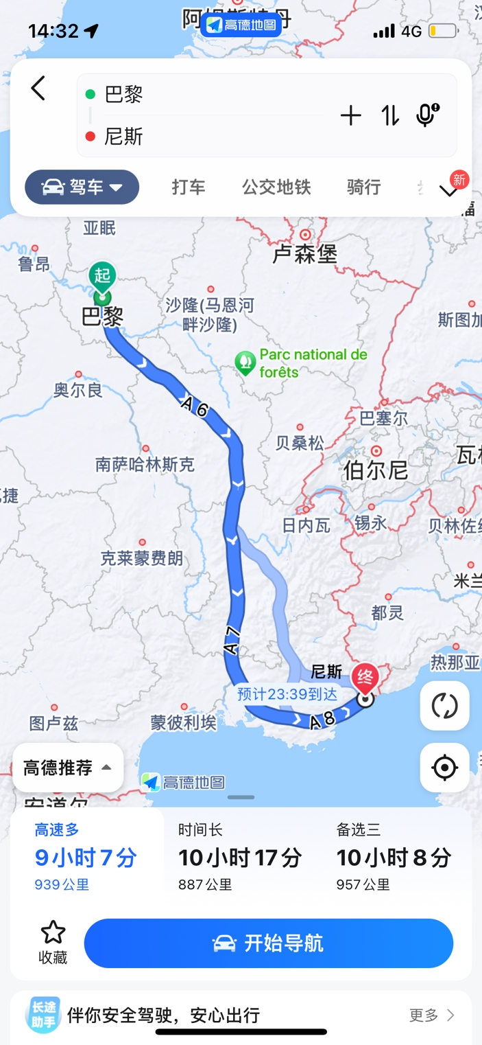
Nowadays, overseas route planning and navigation services can be realized on the Autonavi world map empowered by Beidou Global. Just like in China, users only need to set the starting and ending points, and they can get a complete and reasonable driving or walking route planning plan on the APP. Estimate the arrival time and distance in advance, and choose to navigate to it with one click.
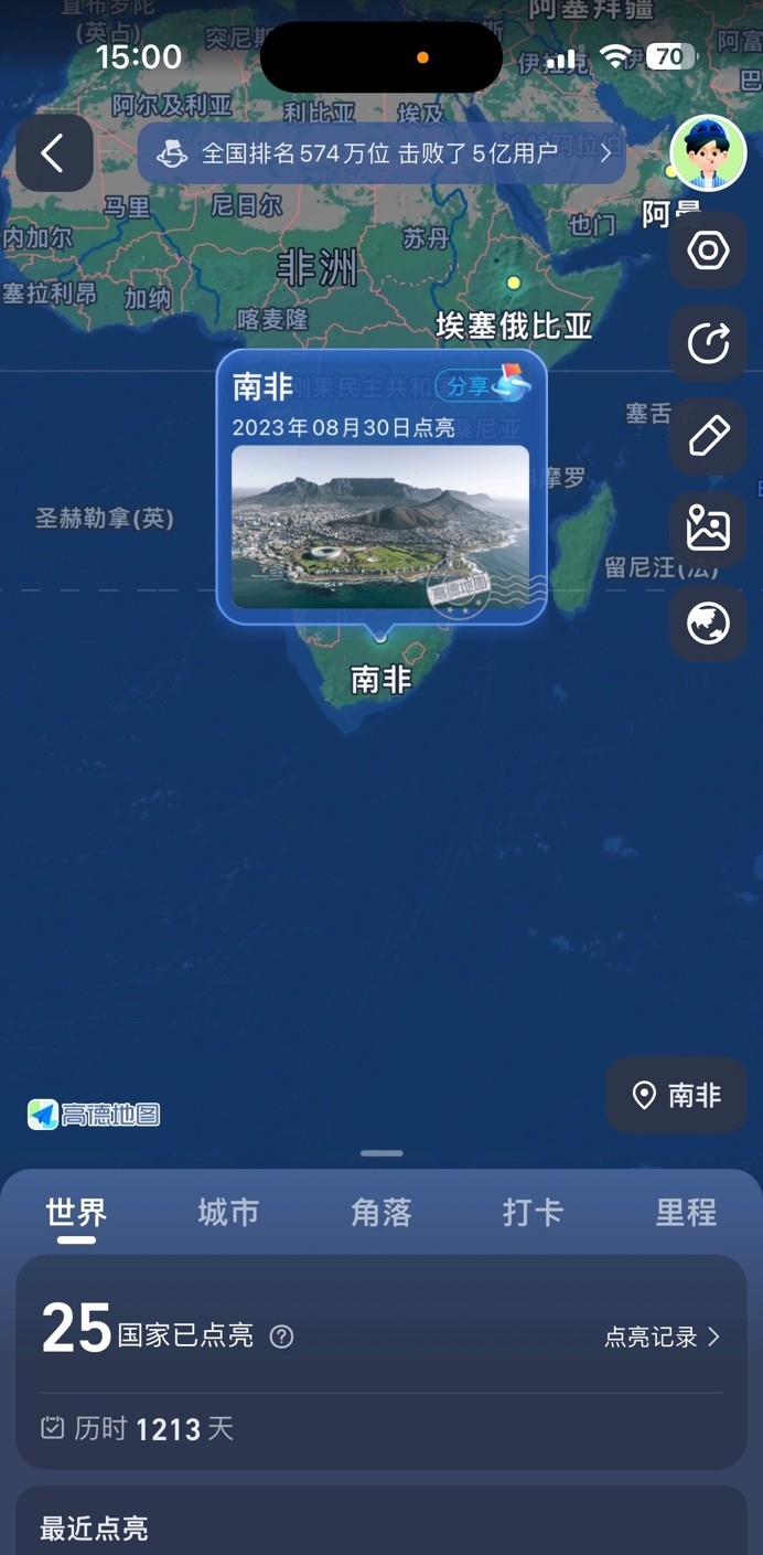
Based on the itinerary location records, the Autonavi world map also allows users to light up the countries and cities they pass through on the APP, and save them in the Autonavi account for easy viewing at any time in the future.
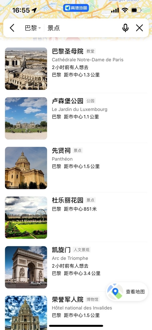
In addition, when users are in certain regions, such as countries and cities along the "Belt and Road Initiative", they can also view the surrounding lifestyle services on the Autonavi map, including restaurants, attractions, hotels, shopping malls, etc., to better understand and experience the local atmosphere.
So far, Autonavi World Map has been launched in more than 200 countries and regions around the world, and users can use it after upgrading the Autonavi Map APP to the latest version.
China’s technology lights up the world, helping to build the digital "Belt and Road Initiative"
"As a technology-based technology company, Autonavi has focused on" making a living map "in China for more than two decades. Now we want to go abroad and upgrade to" a world map for the Chinese ". Liu Zhenfei said that China’s technology going overseas is a big proposition. With the rapid development of China’s economy and industry, many companies have begun to think or layout globally, and some companies have achieved remarkable results in overseas markets." Today, I think Chinese technology companies go overseas, they have technology and strength, and what they need more now is a kind of’at this moment, it is me ‘courage. "
Autonavi World Map was born in this context. The product allows users to enjoy navigation services in more than 200 countries and regions around the world, and can light up the countries and cities that pass by and leave footprints along the way. Autonavi World Map will also be committed to serving Chinese industries going overseas. Based on open ecological construction, it will assist Chinese enterprises to go abroad and achieve global business development.
"Based on the accumulation of more than 20 years of travel technology and service capabilities, Autonavi will also actively participate in the construction of the digital’Belt and Road Initiative ‘. I hope that in the near future, more and more Chinese companies can be seen on the world map." Liu Zhenfei introduced that in the future, the user-centric service concept will continue, and the Autonavi map based on China’s advanced technology will be further developed into a world product serving people around the world. "This is the great initiative of the’Belt and Road Initiative’, which brings us spiritual inspiration."
From September 2nd, Autonavi World Map will start to provide map navigation services for overseas countries and regions for the "Belt and Road Initiative Global Tour" activity.
It is understood that this special event of the "Belt and Road Initiative Global Tour" will focus on some cities along the "Belt and Road Initiative" and important cooperation projects between China and foreign countries as the route, and the inspection and reporting team will travel through a total of 5 provinces, autonomous regions and cities in China and 15 overseas countries, lasting more than 3 months.
关于作者